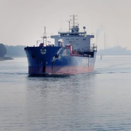
Nautical safety in ports and waterways
Ports and waterways enable safe and efficient nautical operations, such as sailing, manoeuvring, loading and unloading. This requires an understanding of the effects of water levels, waves and currents on vessels and shipping infrastructure such as breakwaters, quays and locks. But congestion and extreme weather events challenge maritime logistics. Deltares assists the maritime sector by improving predictions of water depths, currents, and waves, among others.
Understanding interactions between vessels, waterways and infrastructure
Deltares combines expertise in the field of hydrodynamics and morphology with knowledge about vessels and infrastructure. We advise managers and users of ports and waterways about safe and efficient nautical operations. This can take the form of analyses of hydro-meteorological data (metocean conditions), wave penetration and tests on breakwaters for the development of new port infrastructure.
We also advise on improvements to the design (including the nautical design) of existing infrastructure. With the software we develop in-house and experimental facilities, we advise on areas such as changes to port layouts, mooring technologies and lock operations. For example, we advised Rijkswaterstaat (the Dutch Directorate General for Public Works and Water) about safe lock operations for the new sea lock in IJmuiden. Managers can draw on our advice to use their infrastructure more efficiently and design it more sustainably.
Testing innovations with field measurements, scale models and data science
We use field measurements and scale models to acquire insights that our clients can use to improve their infrastructure and/or operations. For example, we conduct field measurements to determine how moored vessels behave in locks. In our laboratory facilities, we work with MARIN and industrial partners on research (in this case, the HAWAIII JIP) into the effects of low-frequency waves on berthed vessels.
In addition, we are increasingly using data science for the large amounts of data that are becoming available. For example by combining analyses of water levels, wind and waves with vessel position data (AIS data) to analyse nautical safety at sea and in inland waters.


