Case study Dumfries, Scotland
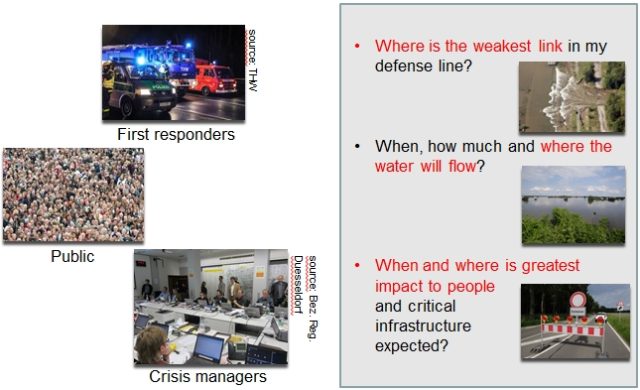
The focus of this project is on developing timely flood maps and impact information to support emergency responders. For this project, the catchment of the River Nith to Dumfries is being used as a pilot study. The tools and techniques have been gathered into a new framework for real-time risk/impact forecasting, referred to as FEWS-Risk.
Results and impacts of the project
- Increased awareness of stakeholders about the added value of forecasted information such as flood spreading, impact to people, economy and critical infrastructure.
- The FEWS-Risk study was presented at a workshop hosted at the National Centre for Resilience with delegates attending from SEPA (Scottish Environmental Protection Agency), Scottish Fire and Rescue Service, Police Scotland, the Scottish Government and Dumfries & Galloway Council. The strength of FEWS-Risk outputs (e.g. flood spreading and impact information, maps of affected infrastructure) was recognized for events and regions where impacts are unknown. For example, decision makers and first responders realized that even warnings with long lead times and high uncertainty are still useful to trigger preparation activities and to start coordination between the emergency organizations.
Future developments
Currently, the FEWS-Risk system is running a shadow forecasting system for SEPA. SEPA explores how they can translate the information generated by the FEWS-Risk system into warnings and guidance to crisis managers, first responders and the public.