Climate and water-robust: the Low-Lying Netherlands in 2050 and beyond
Efforts to make the low-lying areas of the Netherlands climate- and water-robust still take the current situation with respect to land use as their starting point. With technical interventions in the water and soil system, we try to solve problems with the aim of maintaining the current situation. The question is whether, in part given climate change, this is sustainable in the longer term.

The ‘Climate and Water-Robust Low-Lying Netherlands in 2050 and Beyond’ project takes a future-resilient water and soil system as its starting point, rather than the current situation with respect to land use. This creates opportunities to think about solutions that are not solely technical: solutions to the specific challenges in an area (land subsidence, sea level rise, salinisation, water shortages etc.) in a rapidly changing physical context.
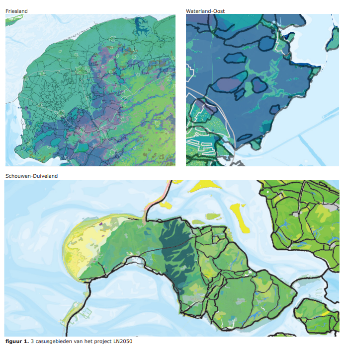
The important thing is to make the future as concrete as possible and not just to produce visions describing that future. We are using the ‘water and soil as leading factors’ principle to produce a possible new planning approach and land use for three areas: Friesland, Waterland-East and Schouwen-Duivenland. To ensure feasibility, we are also looking at building blocks for the future revenue models of a range of stakeholders and the socio-economic impact on the regions.

The work includes an emphatic focus on types of land use with matching functions, and sustainable water and soil management. It should be pointed out that we are working in collaboration with stakeholders from the three areas. We take stakeholders through a step-by-step process, from the current structure of the rural area to an economic, social and climate- and water-robust overhaul for future generations.
The development of a methodology is an important part of the project. That involves working through the steps of a roadmap. The first step for the three selected areas is to determine the broad context of the physical, socio-economic and governance system, in addition to a spatial GIS analysis of agendas and the potential scope for solutions. On the basis of working sessions about Thinking in terms of Scenarios and Development Pathways, we are outlining possible futures and the possible roads leading to them (from the present to 2050 and beyond). Where possible, the results are quantified and visualised in ‘map images through time’. This brings into focus the water and soil system and the associated opportunities for renewed land use. It also provides insights into possible changes in the socio-economic area and in governance.
We are working with our knowledge partners, WUR and KWR. Other project partners include the Friesland provincial authority, the Wetterskip Fryslân water authority, STOWA, the municipality of Schouwen-Duiveland, Rijkswaterstaat, the Noord Holland provincial authority, the City of Amsterdam, the nature organisation It Fryske Gea, and the Noorderzijlvest and Hoogheemraadschap Hollands Noorderkwartier water authorities.

