Navigation Safety in Port Loko River in Sierra Leone
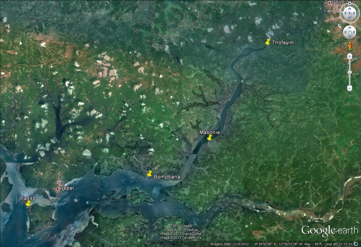
The Port Loko area in Sierra Leone is important for barge transport of iron ore. Figure 1 shows a critical inland reach at Porto Loko River for transport of iron ore from Thofayim river terminal to the seaport. Due to high river currents, particularly during low tide, it is difficult to have safe transport with barges towards the seaport. In the past, accidents have occurred due to complicated navigational conditions, which led to restriction of navigation frequency based on a number of precautions and advices, such as operating during daylight only, avoiding high current periods, depth restrictions due to sedimentation and using two tugs for maneuvering the barges. This resulted in overall reduction of iron ore transport capacity and thereby in severe economic losses for mining industries.
Transport efficiency and nautical safety improved
Deltares, together with partner organisation MARIN, performed hydrological, hydrodynamic and nautical analyses of the critical reach in order to quantify favourable conditions and to provide nautical advice for safe and efficient navigation. Deltares carried out a rapid hydrological assessment to predict critical runoff.
Deltares also developed a detailed two-dimensional hydrodynamic model to compute the local flow fields and water level variations for different scenarios of upstream river discharge conditions (predicted by the rapid hydrological model) and tidal conditions.
The model was calibrated based on water level observations at a number of locations along the modelled river section and on current measurements in the upstream area. The simulated flow fields for different scenarios were used for nautical simulations, for assessments of optimal navigation conditions and for providing nautical advice. With these outcomes the transport efficiency (cost reductions) and the nautical safety have been improved significantly.