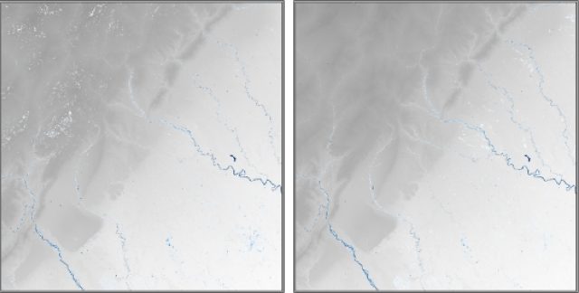
Accurate surface water mapping with optical and SAR data
Fifteen organisations across the world, including Deltares, participated in the WorldWater Round Robin inter-comparison study of satellite-derived water detection methods. The first results are promising. “Our belief that it’s very beneficial to combine Synthetic Aperture Radar (SAR) and optical imagery has been reaffirmed,” says researcher Arjen Haag from Deltares.

High accuracies can be achieved in surface water mapping using optical and SAR data. Optical data are better at capturing spatial detail, while SAR data provide a better seasonal characterization. Both supervised and unsupervised learning can provide very good results. These are some of the most important, initial results from the Round Robin study.
In December 2020, the European Space Agency and the WorldWater project invited interested parties to participate in this inter-comparison of inland surface water detection and monitoring algorithms, using Sentinel-1, Sentinel-2 and Landsat 8 imagery. The European Space Agency initiated the WorldWater project in 2020 to develop innovative methods to monitor surface water variability through an open-source and free-of-charge software toolbox. The Round Robin was specifically meant to formulate new best practices for mapping and monitoring surface water with earth observation data.
Combining optical and SAR data
WorldWater also explores the synergistic use of optical and SAR data for mapping and monitoring surface water dynamics. A number of promising studies have recently demonstrated the strength of such a sensor-fused mapping approach, but until now there was no systematic evaluation to compare other leading approaches for surface water mapping.
The Round Robin compared earth observation algorithms for surface water detection using the latest generation of free and open satellite data from Sentinel-1, Sentinel-2 and Landsat 8. By comparing the robustness of different algorithms, we expect the Round Robin to help us better understand the benefits and drawbacks of earth observation approaches for mapping and monitoring the extent of inland open waters and identifying shortfalls and areas of further research.
Better water management
Fifteen organizations joined the study, representing a mix of research institutions, companies, government agencies and NGOs. All participants were asked to provide monthly maps of surface water presence for 2018 to 2020 at sites located in Mexico, Colombia, Zambia, Gabon and Greenland. All sites were 100x100 km and included data acquired by Sentinel 1, Sentinel 2 and Landsat 8.
The participating organisations ultimately hope to formulate new guidelines for decision makers and practitioners on how to adopt and use earth observation, so they can better capture and report surface water dynamics. It is now possible to support more evidence-based planning and management of water resources through improved uptake of accurate surface water monitoring utilizing Earth Observation data.
Deltares’ role in the Round Robin study
Through our partnership with the SERVIR-Mekong program, we adapted and applied its HYDRAFloods tool to detect water over the various study regions. This tool was originally designed for fast and large-scale flood mapping in Southeast Asia, to assist in real-time disaster relief efforts. We introduced a post-processing procedure to make better use of the strengths of the different satellite sensors, improving its capabilities for detecting water features at higher levels of detail, such as small lakes and narrow rivers.
The current results indicate good potential for the near real-time monitoring of water resources at scale, such as reservoirs, rivers and wetlands. This has implications for water management and water operators who could use this data to make better informed decisions.
Arjen Haag, researcher hydrology and water management at SERVIR-Mekong/Deltares:
“The Round Robin study gave us the opportunity to test our algorithm thoroughly in various regions. The results were good: they reaffirmed our belief that it’s very beneficial to use Synthetic Aperture Radar (SAR) and optical imagery together. We’re happy to have participated in this project and look forward to continue contributing to the best practices in the fast-growing earth observation sector.”
More information about Round Robin.
A revolution in earth observation data
A revolution is taking place on numerous fronts in earth observation. The data availability, both in type and volume, is growing at an astonishing rate, in the public domain and through an ever-increasing fleet of satellites operated by new commercial players. The access to high-speed cloud computing makes it possible to perform calculations on this data in a way that was deemed impossible a decade ago.
An important field of application for satellite imagery is the monitoring of surface water. This can be used in areas like water resource management, wetland monitoring, flood mapping and disaster relief efforts.
The WorldWater project works on advancing the monitoring of surface water extent dynamics, by using the newly enhanced capacities of the latest generation of open and free satellite data from the Copernicus programme. This European programme is one of the most important players in the field, leading the way with the constellation of Sentinel satellites.
Ultimately, it is the hope and ambition that the WorldWater Round Robin Exercise can contribute with new knowledge and documentation which can help formulate new guidelines for decision makers and practitioners on how to adopt and use Earth Observations to better capture and report on surface water dynamics. With the Sentinel satellite constellation, data has continued to improve greatly, and combined with the advances in technical infrastructures for big data analysis, it is now within the realm of countries to implement national Earth Observation based surface water monitoring systems to support more evidence-based planning and management of water resources and for publishing and disseminating data and statistics on the SDG indicator 6.6.1.

