Novel irrigated areas identification framework for better water management practices
To identify irrigated areas Deltares and WUR (Wageningen University & Research) researchers have set up a novel framework that combines hydrological modeling and satellite observations of land surface temperature (LST). Their approach provides valuable insights that can lead to more sustainable and efficient water management practices, starting in the Rhine River basin.

Devi Purnamasari, PhD student water resources management at Deltares and WUR and her supervisors Dr Ryan Teuling and Prof Dr Albrecht Weerts, have used the novel combination of land surface temperature observations and hydrological modelling to identify irrigated areas across the Rhine River basin.
Within the Horizon Europe STARS4Water project, led by Deltares and working together with the Rhine river basin commissions and other stakeholders, the stressed water resources of the Rhine are being investigated. One of the key water demands under investigation by the International Commission for the Hydrology in the Rhine basin (CHR) is irrigation. Globally, irrigation consumes about 70% of freshwater, influencing hydrological cycle and reducing water availability within river basins.
However, routine identification of irrigated areas in the Rhine basin for a hydrological assessment turned out to be a challenge due to inconsistencies in irrigation maps, data limitations, and seasonal variability. Maps of irrigated areas, essential to improve water resource analysis in the basin, were needed to analyse future scenarios.
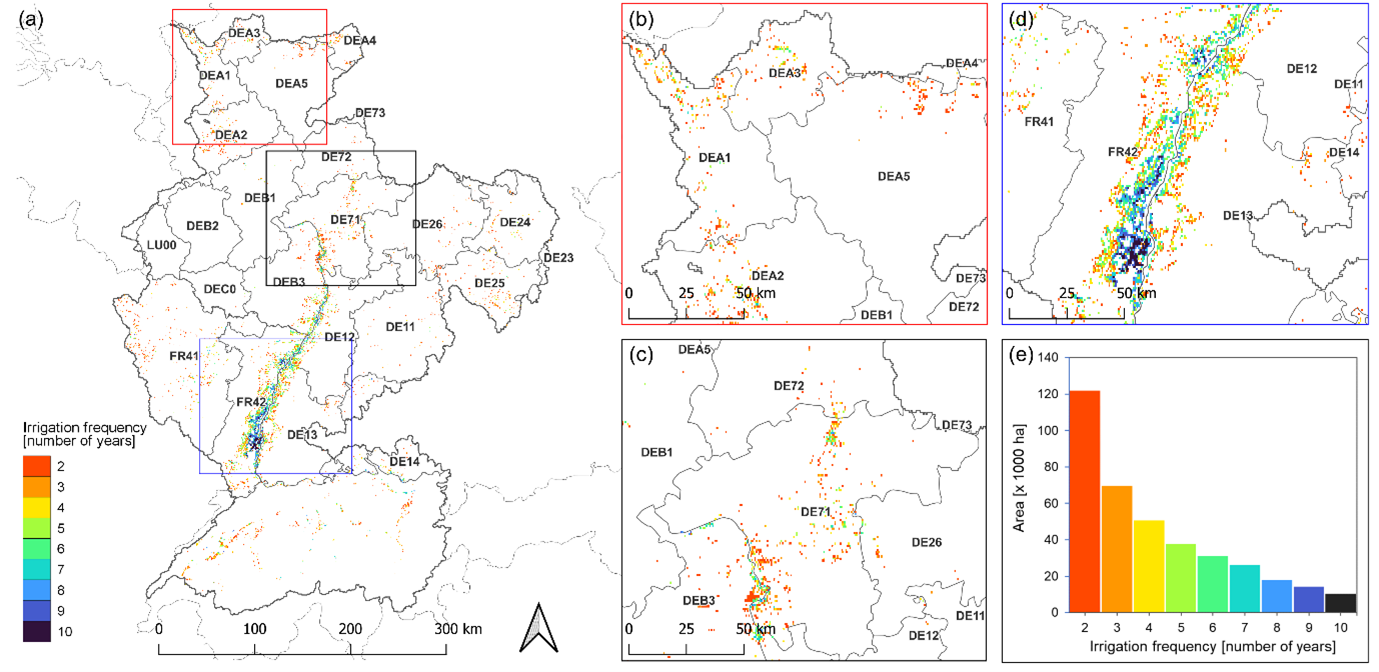
Weerts; “Our research revealed distinct patterns of irrigated areas, showing spatial variations influenced by additional evapotranspiration that is not accounted for in the hydrological model. This finding provides data to improve water allocation strategies and refine hydrological models for the basin.”
Using the high-resolution hydrological model, wflow_sbm, of the Rhine, as well as land surface temperature observations from satellites, irrigated areas were identified for the period 2010–2019. The derived maps are now being used in ongoing research in STARS4Water and the socio-economic scenarios project of the CHR to assess historical agricultural and other anthropogenic water use in the Rhine basin and their effect on discharge extremes
With these newly derived irrigation maps we can improve the assessment of water resources in the Rhine basin for the current and future climate.
Frederiek Sperna Weiland, hydrologist specialising in climate change at Deltares