
Studying dynamics in intertidal areas
Expert(s) |
Reinier Schrijvershof
To what extent do changes in the intertidal zone, places that run dry at low tide, affect waves and currents? And how does this affect the formation of channels and mudflats of an estuary as a whole? To better understand this and collect data with which to test numerical models, Reinier Schrijvershof regularly travels to the Eems estuary in eastern Groningen for his PhD research.
"Through my Earth Sciences studies and my work at Deltares, I became interested in places like this," Reinier explains. "The special thing about an estuary is often the trumpet shape. The Ems estuary still has a hump on that trumpet in the shape of the Dollard, created five centuries ago by storm surges. Today's Dollard is actually only a small remnant, as much land has been reclaimed by reclamation. These land reclamations affected the shape of the estuary: channels for shipping, for example, silted up or shifted. As a result, the access channel to the port of Delfzijl even shifted to the southeast!"
These dynamics made Reinier the subject of his doctoral research at Wageningen University (WUR). He likes to look from a system perspective, or helicopter view: how does an entire estuary or coastal area change? Knowledge in this field helps decision-making around water safety, ecosystem conservation and accessibility of deltas like the Netherlands.
To predict how our deltas change under the influence of sea level rise, it is very important to understand the interplay between the intertidal zone and the permanently wet channels
Reinier Schrijvershof, coastal morphologist at Deltares
Tipping point
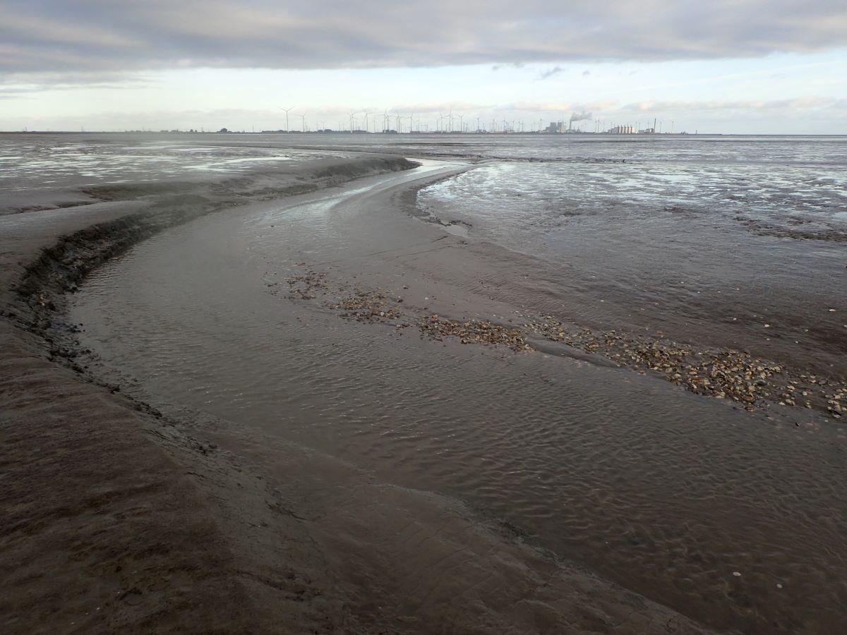
The Netherlands is rich in intertidal areas, for instance we have salt marshes and mud flats in the north, and salt marshes and mud flats in Zeeland. "These are all areas that flood during high tides and are subject to change. Under the influence of sea level rise, intertidal areas in an estuary or tidal basin can play a completely different role," explains Reinier. "If the sea level rises faster, mudflats, for example, can 'drown' and are always under water. So then it is no longer an intertidal area. This not only threatens the ecological value of the intertidal zone, which serves as a feeding and breeding area for birds and seals, among others, but also causes changes in currents and the movement of sand or clay. The system can then reach a tipping point. To understand and predict how our deltas change under the influence of sea level rise, it is therefore very important to understand the interplay between the intertidal zone and the permanently wet channels."
Contours
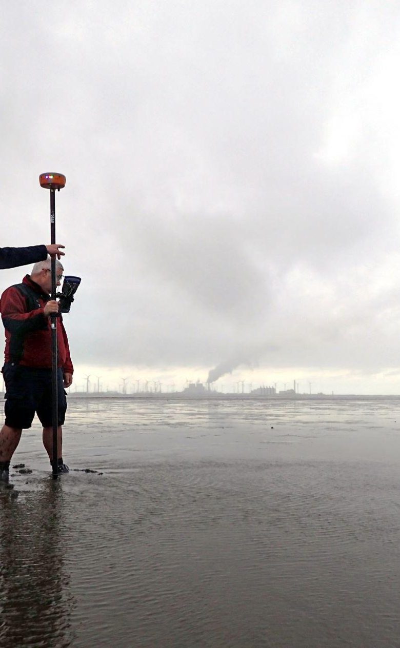
How the intertidal zone affects the tide has not previously been calculated from field measurements. For Reinier's doctoral research, he therefore called on the help of Rijkswaterstaat (the Directorate-General for Public Works and Water Management), because taking field measurements at this location is quite a logistical operation.
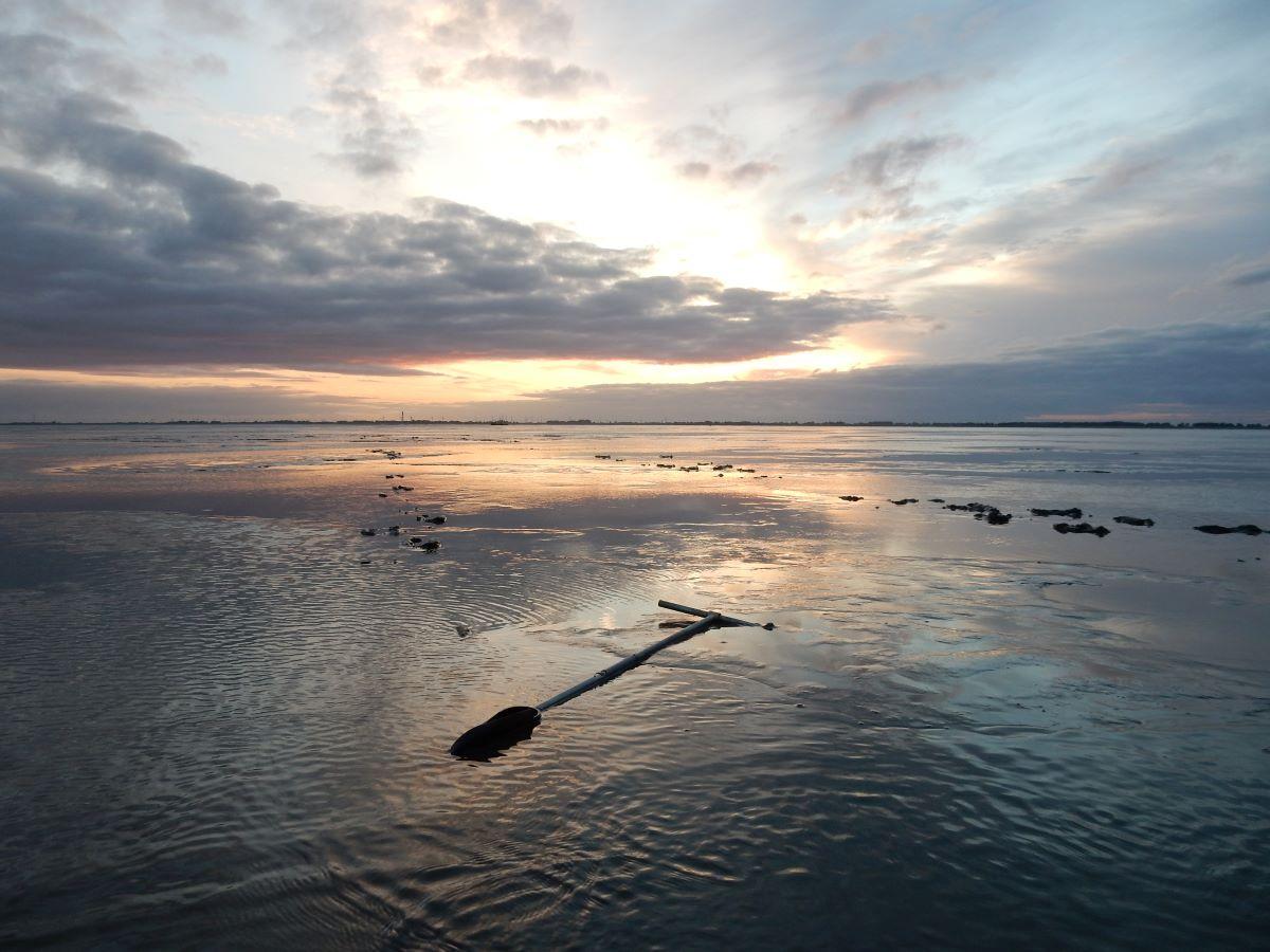
Together with Reinier, Rijkswaterstaat deployed nine measuring instruments in a predetermined grid on Hond-Paap, two lower adjacent mudflats in the estuary. Armed with a GPS antenna and an auger, Reinier and Rijkswaterstaat staff ploughed through the silt of the Ems to determine the right spots for these so-called Acoustic Doppler Current Profilers. Besides measuring currents and waves on the mudflats, three boats were used to measure the upwelling and downwelling of the mudflats during an entire tidal cycle. "Planning all this took a lot of energy. But how special it was to see a whole landscape emerge at low tide," says Reinier. "Normally, you see a big sea, but when the water is gone, the contours of the land underneath draw out beautifully."
Apart from helping field measurements in the Ems estuary to gain a better understanding of an intertidal zone, the data Reinier collects also provide for being able to test numerical models that mimic tidal flow. "A mudflat consisting of bare sand has a very different impact on waves and currents than a salt marsh consisting of silt and vegetation," Reinier said.
The analysis of all measurement data will start in 2025 and will conclude Reinier's PhD research.
